
Volume Calculations
Other Products and Services from CD Surveys Ltd

Floor Plan Surveys
Floor plans surveys can be required for record purposes, area calculations, possibly for letting or for refurbishment. The standard prerequisite is to survey walls internally and externally, doors with swings, overhead beams, access to above voids/roofs, windows, stairs, sanitary ware etc. Other detail such as radiators, lights, light switches, major pipework and other fixtures would be quoted as a separate fee. The most common plot scale for floor plans are 1:100m.

Section 38/109 Drawings
Section 38 relates specifically to the creation of new highways upon land in the ownership of anyone other than the highway authority. It is an agreement between the land owner and the authority for the construction of new highway and the ultimate adoption by the authority as a public highway.
The agreement secures a bond for the cost of the works, to enable completion of the works by the authority upon default by the developer, usually for reasons of insolvency but occasionally in instances where the developer has failed to complete the works within a specified or ‘reasonable’ period of time. The agreement also identifies fees payable for supervision by the adopting authority. Any developer or his consultants must enter into a process of submitting detailed design proposals to the authority for approval prior to construction works and sometimes the agreement will not be entered into until the highway authority has been satisfied that all of its criteria can be met.
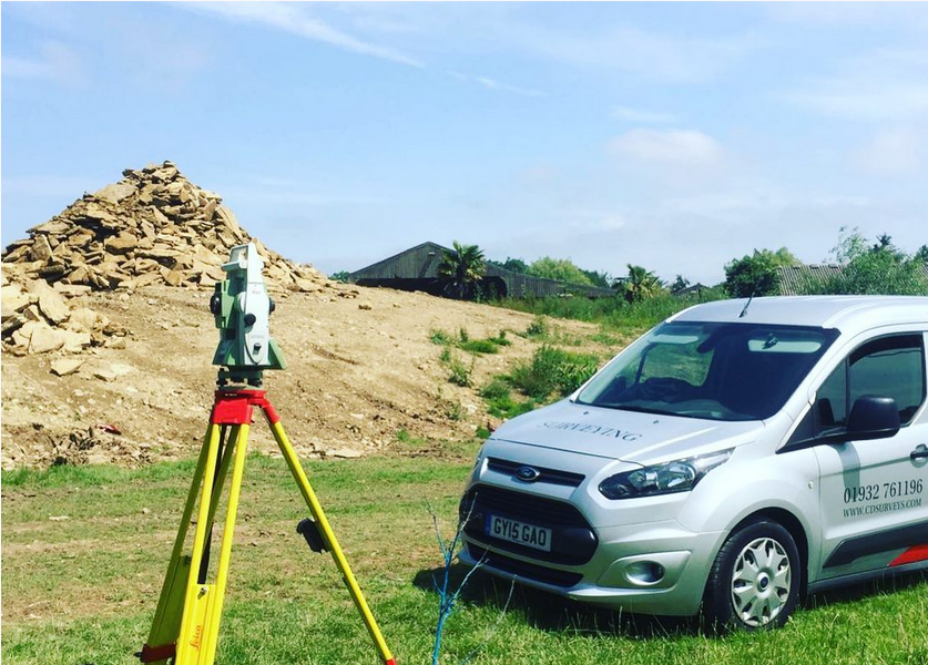
Site Setting Out
The co-ordination and location of permanent markers to withstand the rigours of site operations are also required and we can provide relocatable points of reference to either Ordnance Survey control or arbitrary grid data. We perform topographical surveys before or after site work, to ascertain quantity of land removed or working along side ground workers to define levels for foundation or final profiles. Relocating existing property boundaries from title deeds or registry plans, or assisting in the definition of new or disputed ones, we are frequently called on to establish/confirm fence lines or wall positions.
Provision of the above information can be issued in 3 dimensions for input into a BIM system for total management of a building or construction project.

CD Surveys Ltd
Pentire Stable, Fordbridge Road, Sunbury On Thames, Middlesex, TW16 6AX, United Kingdom
CD Surveys Ltd are a Middlesex-based surveying and engineering company specialising in architectural solutions for interior and exterior structures. Specialising primarily in land surveying, site engineering, measured building surveying and 3D laser scanning, our company has an impressive wealth of experience in professional surveying and consultancy for commercial and industrial projects. We are a very customer-focused company providing professionalism and efficiency across all applications, working closely with all clients to ensure that they receive excellent service.