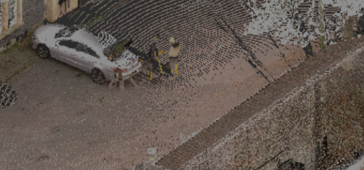
Laser Scanning Technology
It works by shining the laser onto the object and then collecting the data from another sensor such as a camera. This creates point cloud data with millions of 3D XYZ coordinates that can be placed together to build an accurate survey and model of the building.
Other Products and Services from South West Surveys
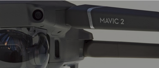
UAV / Drone Surveys
At South West Surveys we run our own in-house drone operations with fully insured, CAA approved pilots.
Drones are a fantastic tool to our surveying arsenal, collecting data from otherwise out of reach places and areas of high risk such as railways, motorways, dilapidated structures or small islands. Covering large areas of land, from open farmland to woodland, our lidar system can penetrate tree canopies and map the ground beneath. Drones can provide you with a wealth of data including plant health and vigour, weed location and density, precise area measurements and elevation changes across your land.
Using our 42mp camera we can provide a set of jpg images, which can also be supplied as a rich 3d pointcloud. This can be for sites in their entirety, or to complete pointcloud datasets where a terrestrial laser scanner would not reach.
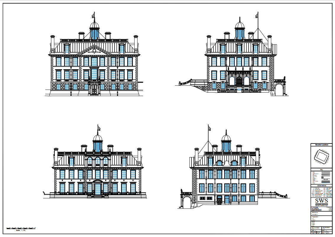
Heritage Elevations
Heritage Elevations.
BIM Surveys & 3D Modelling
Models can be produced from 3D point clouds or 2D drawings. These can be supplied to us or we can visit your site and deliver a full service from the initial site survey right through to the final 3D model.
Any building can be modelled from the simplest of dwellings to the most complex historical building.
3D models have many uses; they make fantastic marketing tools for developers and help local authorities visualize future developments. 3D models also help architects to see their latest creations in a real-world environment.
BIM (building information model) is becoming increasingly popular, especially with government projects as recent advances in legislation has meant large growth in the number of 3D models needed, this makes our BIM models a great resource for other professional parties to take forward.

South West Surveys
28 Rudgeway Park, Rudgeway, Bristol, Gloucestershire, BS35 3RU, United Kingdom
South West Surveys provides surveying services across commercial, industrial, residential, and local government sectors. Our extensive portfolio includes diverse projects from residential renovations to prestigious heritage sites. We specialise in producing as-built 3D models for BIM and visualisation purposes. Our expertise extends to modelling pump houses and converting laser scans of listed statues into solid mesh models. Collaborating with architects, town planners, engineers, and private clients, we employ advanced equipment like Trimble robotic total stations and 3D laser scanners.