Company details for:
G&J Geoenvironmental Consultants Ltd

Quick Links:
Products / Services
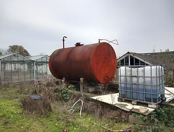
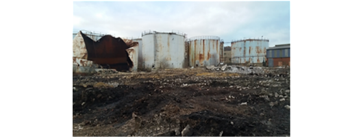
Phase 1 Contaminated Land Desk Study
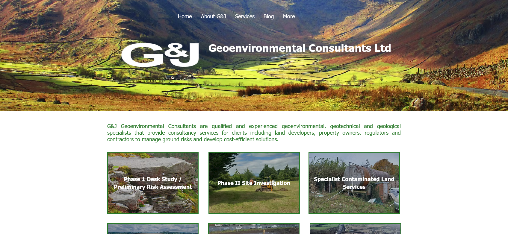
The initial stage of the investigation of contaminated land, commonly required as a minimum to satisfy relevant planning conditions, a desktop study is also an important element of geotechnical investigations to identify the anticipated geology and potential hazards, before intrusive ground investigation works. Background information from withdrawn SGV reports can provide important context and insights that may assist in understanding the decision-making process regarding SGVs and C4SLs. Analysing past uses of the site is crucial to identify historical land uses that may pose contamination risks.
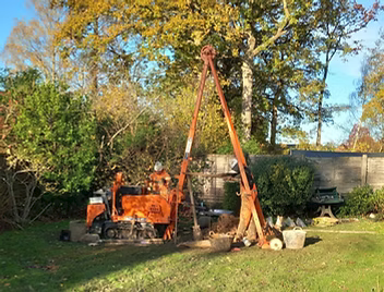
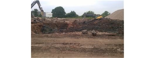
Phase 2 Ground Investigation Services
A Phase II Site investigation is required when a Phase I Desk Study indicates a requirement for further work, and may be undertaken to satisfy planning conditions, as part of the due diligence process to inform the purchase of site, by site owners to identify any geo-environmental liabilities or by developers to determine the geotechnical properties of the ground for foundation and pavement design etc. Phase II Site Investigations are often required to discharge a planning condition.
Understanding the client's objectives and project specifications is crucial to providing tailored services that address their specific needs.
Land Contamination Assessment & Risk Reports
The evaluation of contaminated land begins at the Phase I Desk Study stage (often referred to as a Preliminary Risk Assessment), which determines whether any potentially significant pollutant linkages are likely to be present in the surrounding area, including considerations for groundwater risk assessments. The subsequent Phase II Ground Investigation tests the significance of these pollutant linkages, initially through a Generic Quantitative Risk Assessment (GQRA) based on standard published assessment criteria.
A brownfield risk assessment is often necessary to comprehensively evaluate brownfield land contamination and its potential impact on the environment.
Where a GQRA identifies a potential risk or is insufficient to determine the significance of any risks, a site-specific Detailed Quantitative Risk Assessment (DQRA) can be carried out to more accurately quantify risks and ensure an appropriate response.
Contaminated Land Remediation & Validation
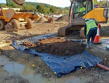
Remediation measures can range from the placement of a simple cover layer of clean soil to a variety of innovative in-situ and ex-situ techniques. Assessing contamination levels before choosing remediation measures is crucial to identify potential risks and ensure effective solutions. Each remedial scheme is site-specific, and we can design solutions for any site, be it large or small, straightforward or more complex. During remediation, we can provide technical oversight and supervision as part of the remediation scheme , together with independent verification of the works on completion.
Ground Gas Monitoring & Risk Assessment
On sites where the Phase I Desk Study or Phase II Site Investigation has identified a potential source of ground gases (such as buried waste, landfill materials, soils with a high organic matter content or historical mine-workings), a suitable programme of gas monitoring can be designed to assess ground conditions and gas risks, forming the basis of an assessment which will determine whether any mitigation measures are required.
Comprehensive data analysis is crucial in assessing risks associated with ground gases, ensuring that all potential hazards are identified and managed effectively.
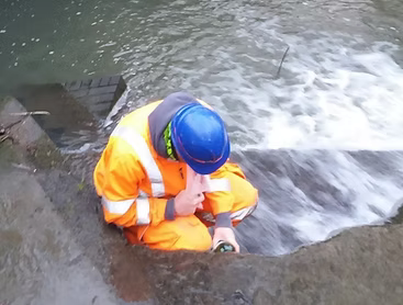
Groundwater & Surface Water Monitoring
The collection of samples of groundwater and / or surface water over a period of time can help detect trends, determine the origin of pollutants, and quantify the effectiveness of remedial works or the impact of natural attenuation processes.
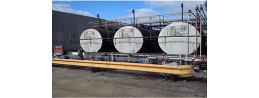
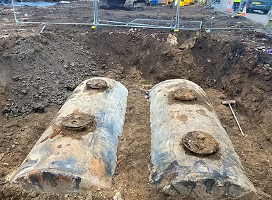
Waste Management & Classification
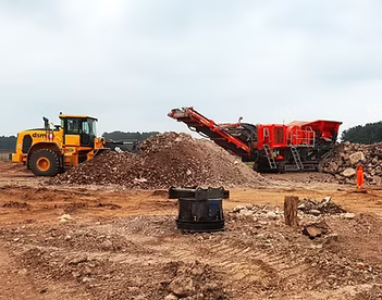
The management of excavated soils can have significant implications for a project budget, given the high cost of off-site disposal. We can advise on the options for re-use of soils on a development site in accordance with waste legislation, off-site treatment or disposal, and the accurate classification of soils as a last resort for those that must be sent to landfill.
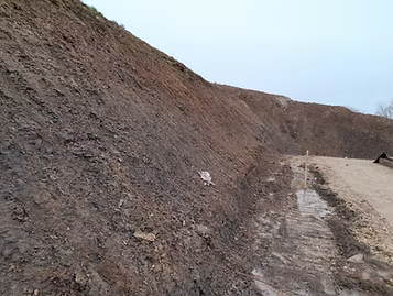
Slope Stability Assessment
Slope failures can have major effects on structures and infrastructure, and even heath and safety, so it is essential to ensure that proposed slopes resulting from earthworks are stable in both the short and long-term. Existing slopes can, of course, also fail for a variety of reasons and are likely to need investigation and possibly remedial works.
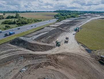
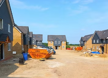
Earthworks Specification, Supervision & Validation
Earthworks projects can range from minor ground level changes on single plot residential development to major earth moving projects for large commercial and residential developments, to infrastructure projects of all sizes. Regardless they are all likely to require some level of design, monitoring and validation.
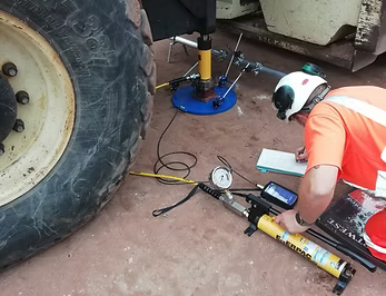
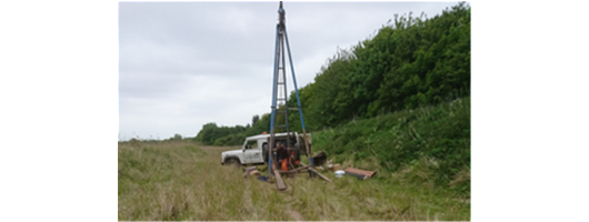
Geotechnical Engineering Services & In Situ Testing
Measurement of factors such as groundwater levels, pore water pressures, slope movement and settlement, especially over an extended period, can be vital in assessing long-term risks during ground investigations and determining the best remedial strategy. Implementing cost-effective solutions in geotechnical engineering projects is crucial as it not only ensures safety and sustainability but also leads to significant cost savings for clients. In-situ testing during ground investigations and earthworks is carried out to better characterise the ground conditions and ensure that specifications are being complied with.
Geohazard Assessment & Risk Management
Geological hazards (geohazards) have been formed in the ground by a combination of the region’s geology and ground conditions, sometimes with a significant human input or trigger. Although often predictable, they are usually unexpected when their effects become apparent, highlighting the importance of a systematic process in geohazard assessment.
Personnel involved in offshore operations can face severe situations due to geohazard impacts, emphasising the need for thorough risk assessments to ensure safety.
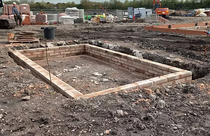
Ground Bearing Slab & Foundation Design Services
When required by the client, G&J’s Phase II Site Investigation reports will include preliminary foundation and floor slab recommendations. If this investigation reveals or confirms the presence of specific hazards, then recommendations for targeted further investigation will be made to allow more detailed foundation design as required.
The construction of a ground-bearing slab involves meticulous planning and execution to ensure its stability and longevity. The frost protection on the Vario panels is achieved with a surrounding layer of concrete, highlighting the effectiveness of their product solutions for different building conditions.
The installation of a ground bearing slab requires careful attention to detail, including the use of high-quality materials and the compaction of the concrete to prevent damage and ensure a hard, durable surface. Various components such as PVC ducts, lifting systems, and reinforcement steel are installed to ensure structural integrity and functionality.
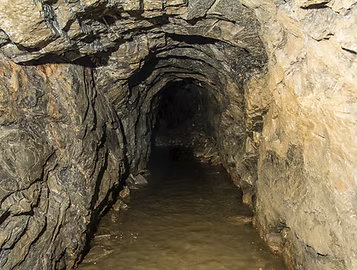
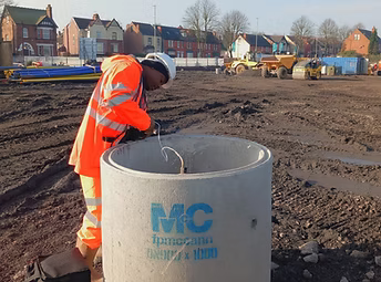
Mining Risk Assessment & Investigation
The UK's mining legacy can pose significant risks to the development of land in many areas; G&J can assess these risks, carry out suitable intrusive investigations where required, and if necessary design, supervise and report treatment works.
Planning & Regulator Approval
A close working relationship is essential to address land contamination and / or geotechnical development issues to the satisfaction of regulators and warranty providers. G&J aim to engage productively with such organisations including Local Authorities, the Environment Agency and the NHBC at an early stage.
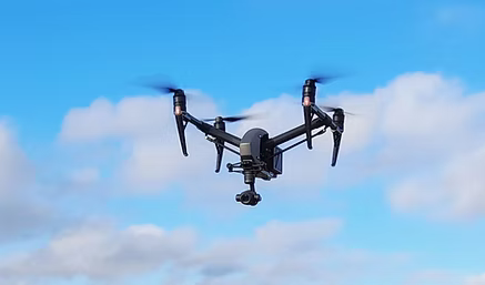
Drone Services
G&J's drone team, with qualified and insured drone pilots and experienced photographers, can provide clients with a new perspective on their land or developments. After carrying out rigorous risk assessments the drone can legally fly up to 120m above ground level to get the wider view, although the best photographs are often taken at a relatively low levels.
About us
At G&J Geoenvironmental Consultants Ltd, we prioritise meeting our client’s needs in a cost-effective and professional manner. We pride ourselves on open and effective communication with clients and key stakeholders, ensuring their expectations are always considered and achieved.
We are committed to designing cost-effective, pragmatic, sustainable, and achievable solutions. Our personnel are experts in their fields, well-versed in the latest legislation and guidance, ensuring that professional quality standards are consistently met.
Moreover, we emphasise the importance of managing Health & Safety risks at all times, making it a fundamental aspect of our approach to every project.
Our Services Include:
Site Investigation Services
Our site investigations typically begin with a site walkover and Phase I Desk Study, which help define a targeted scope for any subsequent intrusive investigation. Many investigations are conducted to discharge contaminated land planning conditions, and we ensure regular liaison with regulatory authorities to gain acceptance of the investigation strategy before proceeding. Intrusive site investigations often assess ground gas issues, soil/groundwater contamination, mine workings, and geotechnical information for development. G&J also offers independent reviews or second opinions on previous appraisal reports. We have investigated various sites, including greenfield sites, former farms, petrol stations, foundries, chemical works, gas storage facilities, backfilled pits, recently developed sites with unresolved issues, and sewage works.
Geoenvironmental Services
In addition to conducting general site investigations on potentially or known contaminated land, G&J offers standalone or bespoke assessments to address specific geoenvironmental issues on land or water. These services include Phase 1 and Phase 2 Contamination Assessments, Detailed Quantitative Risk Assessments (DQRA), Ground Gas Assessments, Environmental Monitoring Services, Remediation Strategy Design and Validation, Environmental Impact Assessments, and Due Diligence Assessments.
Geotechnical Services
G&J offers a range of geotechnical services as part of a general Phase 2 site investigation or as standalone assessments to meet specific client needs. These services include intrusive investigation of soils and rocks, provision of foundation recommendations, slope stability assessments and remediation design, geotechnical monitoring (e.g., slopes, settlement), investigation and mitigation of natural geohazards (e.g., sinkholes, soft ground, peat deposits), earthworks specification, monitoring and validation, assessment of concrete design requirements (BRE Special Digest 1), soakaway testing and design (BRE Digest 365), and piling mat designs.
Mining & Mineral Resources
G&J offers a range of geotechnical services as part of a general Phase 2 site investigation or as standalone assessments to meet specific client needs. These services include intrusive investigation of soils and rocks, provision of foundation recommendations, slope stability assessments and remediation design, geotechnical monitoring (e.g., slopes, settlement), investigation and mitigation of natural geohazards (e.g., sinkholes, soft ground, peat deposits), earthworks specification, monitoring and validation, assessment of concrete design requirements (BRE Special Digest 1), soakaway testing and design (BRE Digest 365), and piling mat designs.
Drone Services
G&J's drone team, with qualified pilots and experienced photographers, offers clients unique aerial perspectives on their land or developments. After conducting rigorous risk assessments, drones can legally fly up to 120m above ground level, though the best photographs are often taken at lower altitudes. Services include aerial photography for Phase 1 Desk Studies,
Environmental Impact Assessments, sales and marketing, and site development monitoring. Additionally, they provide georeferenced orthomosaic photo maps, preliminary topographic mapping, measurement of stockpile or excavation volumes, and monitoring of earthworks or remediation and materials movement for MMP reporting.
At G&J Geoenvironmental Consultants Ltd, we specialize in geoenvironmental and geotechnical assessments, particularly focusing on contaminated land sites. Our commitment is to meet client needs in a cost-effective and professional manner. We uphold principles of open and effective communication with clients and stakeholders, ensuring their expectations are met and often exceeded.
Our team designs pragmatic, sustainable solutions tailored to each project, guided by the latest legislative requirements. We place a strong emphasis on maintaining high professional quality standards and rigorously managing Health & Safety risks throughout all our operations.
We also provide remediation validation strategies and completion reports, ensuring that all remediation activities are thoroughly documented and meet regulatory standards, thereby safeguarding both the environment and public health.
Images