OS GNSS & GPS Survey
The processed data is then available to the Project Team in various forms to ensure everyone has the highest quality information to hand. This is a system set up and controlled by the U.S. Military. They have at the time of writing, in combination the set up is around 30 satellites in orbit around the earth. These satellites send signals to earth, GPS receivers on the ground pick up these signals. The receivers use the signals from a number of satellites to calculate their own position on the earth’s grid reference system with a sub millimetre accuracy, depending on the equipment used.
We have found that GPS surveying technology is versatile and adaptable and could be utilised in most civil engineering and construction projects. It is user friendly and can link up with various software applications to give the professional surveyor an accurate and all-round surveying tool. Surveyors can work independently from other surveyors on site, allowing greater productivity. However redundancy is required to ensure a robust output is acceptable to the deliverables. This may involve multiple readings over a span of time or be proven with conventual means.
Other Products and Services from CD Surveys Ltd
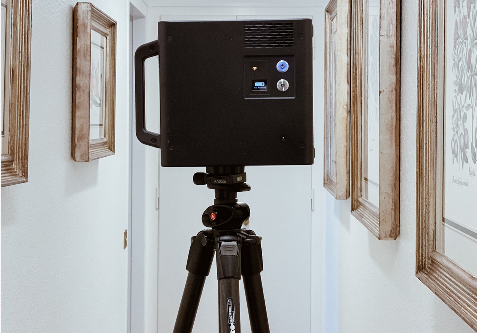
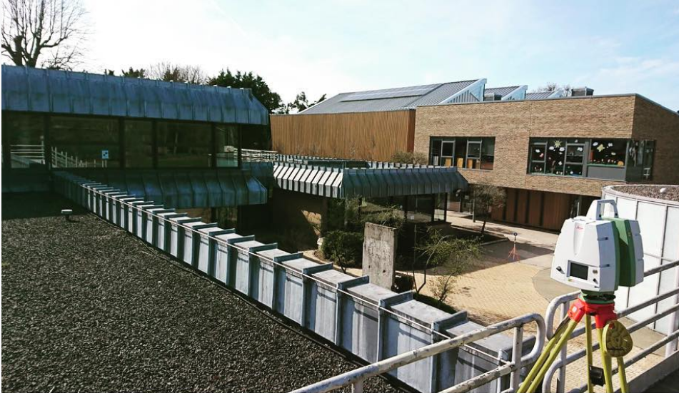
3D Laser Scanning
Using either our Leica P40 scanner or our FARO X 130 3D scanner enables us to record information from site accurately and quickly and in a format that can easily be transferred into design drawings.
Our specialist team of experienced surveyors are able to capture data at a rate of up to 1 million points per second, as a result measurements can be made quickly and easily without return visits to site.
We currently offer the use of the laser scanner for various different services:
Detailed measured building surveys
Street scene elevation surveys
Highway surveys
As-Built surveys
Monitoring
Heritage scanning for posterity
Inaccessible and hazardous locations
We can present the data to you in the following formats:
2D drawings (Elevations, Cross Sections, Floor Plans)
Point Cloud
3D Model
BIM / Revit Models

Street Scene Elevations
Provision of any of the above information can be issued in 3 dimensions for input into a BIM system for total management of a building or construction project.

DJI Aerial Drone Survey Systems
Our aerial surveying capabilities have been expanded with two professional, survey-grade DJI platforms: the DJI Matrice 4E and the DJI M300 RTK. These state-of-the-art systems enable rapid collection of highly accurate aerial data, making them well suited for construction, land development, and infrastructure projects.
Aerial imaging offers a safe, precise, and efficient way to capture detailed site information from above. Drone surveys significantly reduce time spent on-site and allow access to hazardous or hard-to-reach areas without risk. The resulting high-quality datasets integrate seamlessly with ground surveys and CAD deliverables, providing reliable and efficient project outcomes.

CD Surveys Ltd
Pentire Stable, Fordbridge Road, Sunbury On Thames, Middlesex, TW16 6AX, United Kingdom
CD Surveys Ltd are a Middlesex-based surveying and engineering company specialising in architectural solutions for interior and exterior structures. Specialising primarily in land surveying, site engineering, measured building surveying and 3D laser scanning, our company has an impressive wealth of experience in professional surveying and consultancy for commercial and industrial projects. We are a very customer-focused company providing professionalism and efficiency across all applications, working closely with all clients to ensure that they receive excellent service.